Collective noun for chuggers

Sitting in the office at lunchtime, we looked out of the window and saw 4 chuggers standing around the end of Bond Street. I was intrigued about the collective noun, so tweeted:

what’s the collective noun for chuggers? There are 4 of them huddled around a lamp-post at the Bond Street/North Street junction

I got quite a few replies, some via twitter and some via facebook.

Helen suggested:

A pillage of chuggers? An infestation of chuggers? A coven of chuggers?

Relly offered:

A campaign of chuggers? A smarm of chuggers? A knifetwist of chuggers?

Simon came up with:

A I-must-tell-you-I-get-paid-for-doing-this-but-its-still-a-good-cause of chuggers?

Seb responded with:

I would say an irritation of chuggers 🙂

which I rather liked, but Dave’s offer of:

that’s an “ambush of chuggers”

was the one I declared to be my favourite

60 Hours in Hong Kong

I don’t remember when I first learnt of Hong Kong, I know it was whilst it was still under British rule. It interested me as a city, in theory at least, being an easily navigable city with lots to see. As we planned our trip to Australia to visit Jono and Anna for their wedding it seemed like a golden opportunity to visit.

We arrived at Hong Kong reasonably early on the Monday morning between Christmas and New Year and made our way to Kowloon, and the Hotel Benito, via one of the airport buses. We couldn’t check in for a few hours so abandoned our stuff and spent some time exploring the area surrounding the hotel and discovering Kowloon Park and it’s free government wifi.

Plant tree and gardener in Kowloon Park

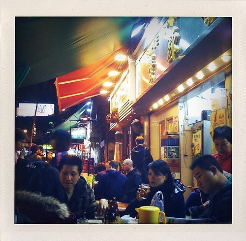
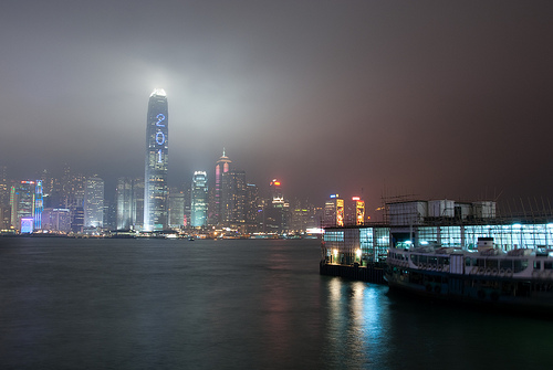
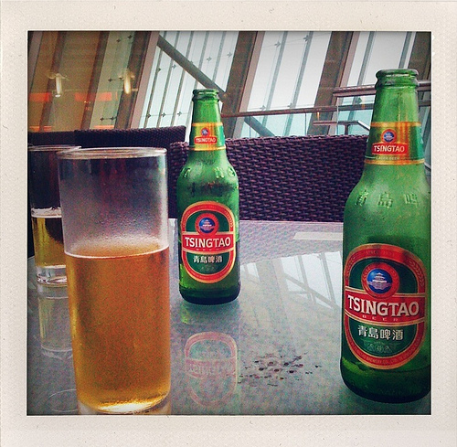
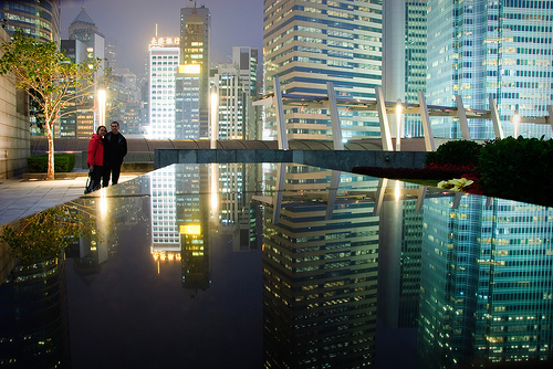
After check-in, naps and a freshen up we headed back out for further exploration, still staying in the Kowloon area, taking a walk down to the Temple Street night market where we found food and beer, before heading back towards the Avenue of stars to take some night photographs of the skyline.

Night market, Temple Street, Hong Kong

Hong Kong Island at night

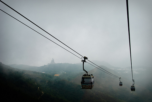
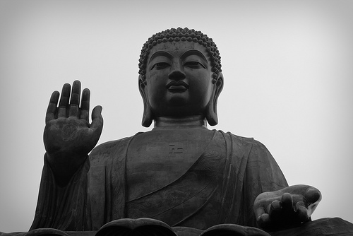
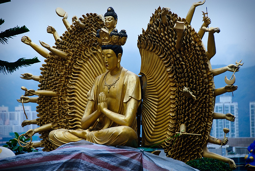
Our only full day started late due to the excitement of Christmas and travelling catching up with us, but after a quick trip to a nearby bakery to feed ourselves, we headed off to the nearest MTR station to pick up our octopus card (pre-paid travel card – similar to an Oyster card in the UK). Armed with our travelcards we headed off to Lantau Island to take the Ngong Ping 360 cable car to see the Po Lin monastery and the Tian Tan Budha.

Cables in the cloud

Tian Tan Budha

Praying

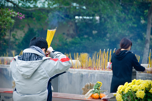
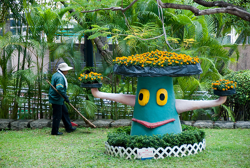
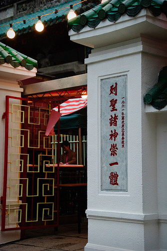
After lunching at the monastery, we made our way back towards town and stopped off at Hong Kong Island for some exploring around that area, including, of course, a trip on the Central Mid-levels escalator and a trip to the Man Mo Temple.

Man Mo Temple

After our fill of culture, we headed off to check out a few recommendations from a friend of mine who lived in Hong Kong for a few years, so took in the Red bar at the IFC before finishing our evening at Lin Heung Tea House for dinner.

Beers at RED bar at IFC

Richard and I on the roof of the IFC

Our final day in Hong Kong, so after another bakery based breakfast and checking out of the hotel (and leaving our bags) we headed off to the 10,000 budha temple as our final cultural experience of Hong Kong, well, if you don’t include food courts in department stores, haggling for iPhone related stuff (case, charger etc) as cultural before getting our bags, getting on the airport express and waiting for our 10pm flight to find Jono and Anna in Sydney (of which more in another blog post).

Winged praying buddha

We used an iPhone app as our main guide which turned out to be excellent and was based on the wikitravel Hong Kong information. See Richard’s post for information about which other apps we used.

60 hours in Hong Kong was a reasonable amount of time to see most things – it was pretty cloudy most of our time there, so there was no point in heading out to Victoria Peak. The timing of our visit, between Christmas and New Year, made this even more interesting, as the cultures collide between dim sum, noodle bars and piped Christmas music from every possible outlet. The general cries of “copy watch, copy handbag” and “new suit, new tailored suit” at every corner were accompanied by the occasional jingle bell rendition – most odd. As a stop over destination, I really enjoyed it, and would gladly stop in Hong Kong again. It was everything I’d imagined it to be, an interesting city which, as an English speaker, is relatively accessible without too much difficulty.

Travel apps we used.

During our time away in Hong Kong, Sydney and Tokyo, we decided to use iPhone apps whenever possible to get by. These are the apps we found useful:

  • Instapaper – brilliant for keeping light reading to hand.  The pro version is needed unless you can live with just a small number of pages.
  • Dropbox – for travel documents, and entertainment.
  • Built-in Maps app – generally filling the cache when we had WiFI and then using the GPS on the 3GS to find our way around.
  • The built-in Screen shot (hold iPhone menu button and power button) – great for capturing images of maps  with a route on when you have WiFi but think you might lose the map or directions out of the cache later.
  • Todo – for getting junk out of our heads so we could forget about stuff and enjoy ourselves.
  • FelaurPDF – transport maps which were too large to view on the in-built PDF viewer.
  • Power Plug – visual reference for the power sockets around the world.
  • Metro – for finding our way around Hong Kong and Tokyo.
  • Weather Pro – use this everyday to plan for the weather.
  • Currency – handy for converting back to GBP.
  • The built-in camera app – obviously, but useful to snap route information to look at later.
  • Sydney Travel Guide  from Fidesereef
  • HongKong Travel Guide also from Fidesreef.
  • Tokyo Travel Guide from Fidesreef, again.
  • Tokyo Zuti for getting around the train system.
  • Tokyo Cool City Guide
  • Transit Sydney
  • Sydney Street Map – offline map with GPS support.
  • Hong Kong 720 (useful before we went)
  • NHS DrinksTracker – for keeping score.

We also had TripIt, Dopplr and TripAdvisor apps, but I don’t think we used them.

We picked up one paper guide: at Sydney airport we did a Loney Planet “print and bind” of a chapter of Tokyo from one of their travel guides.  This was so that I had something to use on the flight to figure out what we were going to do in Tokyo in a limited amount of time.  As a bonus, the guide was bound in an anonymous brown card, making us look less touristy if we needed to refer to it.

Jane paying for a printing a Tokyo guide

Le Tour de France 2010

I started following the Tour de France in around 2002 thanks to sharing an office with an avid tdf fan, Jeremy. A few years later we got to see a couple of stages when it was in the UK. I’ve maintained an interest over the years, and thought I’d share the various media I’m using this year to keep in touch.

  • ITV’s excellent Tour de France highlights programme – pretty much the same familiar format every year – ITV also have live coverage on their website, but I’d generally rather watch the highlights in an evening
  • ITV’s podcast – nothing different to the tv really, but still comforting.
  • Radio 5 lives sports extra’s broadcasts – 3 scheduled during this years tour.
  • Tour 2010 iPhone app – I couldn’t justify paying £5.99 for the official app, especially when the free taster app seemed so slow and unresponsive, so I went for this bargain 59p app instead. It is pretty responsive, seems to handle the live updates reasonably well, and seems pretty accurate and provides at a glance views of tables, stages etc. Screenshots (taken in relation to stage 4) are below for those looking for a review of this app.
  • Twitter list described as “Riders, management, photogs, journos likely to be at the Tour de France 2010” and quite a good way to see what the people in the know have to say

Review: The iPhone app – Tour 2010 by Simu Soft

p_480_320_F25FD062-479B-4F99-A6CA-B4E9FB3DACC2.jpeg

Classification View
This is a splash screen showing a yellow, green and polka dot jersey. Clicking on one of them takes you to a detail page. It doesn’t give the White shirt details – which is shame as the UK’s Gerraint Thomas is currently wearing it, but it does show the GC, green jersey and king of the mountains, in each case offering a rider view and a team view:

p_480_320_95165894-8BAF-41CA-8CB6-83B21AA76FA2.jpeg

p_480_320_ABA407A0-EB70-4621-A416-A393AAFAED21.jpeg

Stage View
The stage view changes according to whether the stage has happened yet.

Before the stage: gives an expected start time, and highlights the interesting points (mountain points and sprint points)
p_480_320_01FB4E84-4619-41A0-A0CA-53BD91B87F56.jpeg
During the stage: visual indicator of proportion of race completed, information about gaps between breakaway, peleton and any other groups along with a second page showing further details
p_480_320_CB8CD33F-5B70-43D4-ADE4-245D39C1F85D.jpeg

p_480_320_8AC5083F-9B10-4B70-AAE7-4983850EE705.jpeg

After the stage (there is a delay between the stage finishing and the data updating): shows the top 3 placed riders in the stage plus the holders of the yellow, green and polka dot jerseys. A second page shows the order the riders finished in, and their time differences.

p_480_320_2F92DE76-ADEC-4DD2-BA23-B257C82C2CC9.jpeg

p_480_320_5D93B49E-048D-4E30-8B30-CC9BE20CD71E.jpeg

Calendar View
The calendar view shows a view of about 5 days at a time of distance, start and end points, expected start time and an idea of the profile of the stage. Great for getting an idea of who the stage will favour.
p_480_320_BEFFC7FB-CA72-45B9-9CDA-F1B83ED3A17F.jpeg

Summary
The application has a few words which haven’t been translated into English, for instance opdated, gruppe etc, but they don’t stop me from following what is going on. The application has also crashed a couple of times, whilst getting updates during the race (it updates at a different rate depending on how much of the race is left). At a price of 59p, these are issues I can live with, but it isn’t quite my ideal app, I would, and have, recommended it to others based on these issues though.

Instead, my ideal app would have:

  • All jerseys listed
  • Team view for classification
  • Ability to view where a sprinters points have come from
  • Ability to see where the king of the mountains points have come from
  • Details on each rider – when a rider is mentioned, you can select the rider in the app, but it doesn’t do anything – would be great to have a fact page including their standings in the various competitions

If anyone knows of an app that does all of what this one does, and my extra bits, then please let me know.